

There are no addresses in Grenada
My researches in the islands

There are no addresses
I’m just back from two weeks in Grenada and its smaller dependency Carriacou. This was a research trip meant to put the finishing touches on a book I have been writing. I won’t burden you with book details. Someday it will be published in all its glory. For now, let me just three highlights of the trip.
Grenada is small, just over 124,0001 people, about 21 miles from one end to the other. Think of it as a kite with the capital, St. George’s, in the tail at the bottom, Sauteurs in the north at the top, and Grenville and Gouyave, two towns on the right and left coasts. In the middle is a spine of jagged peaks, all formed from volcanoes, misty, rain-foresty, cut by fast-flowing streams and waterfalls. Once the land of the Kalinago, it was settled by the French starting in 1649. The British took it over, except for one brief stretch, in 1763 (same treaty that gave them Canada). Independence came in 1974. Then revolution and an American invasion in 1983. During the colonial era it was divided into plantations that used enslaved Africans for labor. Slavery ended nominally in 1834, replaced by a so-called apprenticeship program that was abolished in 1838 when everyone became free finally and officially.
Carriacou is even smaller, tiny. You’d have to run laps around the island to make up a marathon. It has a cordillera of hills, too, but they aren’t massive enough to drive the clouds up to rain-making altitude and thus the island is arid, home to cacti and acacia bushes that made hamburger of my legs when I was bushwacking. Every roof has a system of gutters, pipes, and storage tanks. On both islands, goats roam free, cows, too. On the former Dumfries Estate on Carriacou, there is a herd of donkeys running around. There are no substantial wild animals, just opossums (manicou) and, on Grenada, some monkeys native to Africa (descended, according to Angus Martin, former director of the national museum, from one pregnant female probably brought on a slave ship). You see little lizards, anoles and geckos, and occasional iguanas. There are endangered tortoises, but I saw only (several) red-legged tortoises in the bush.
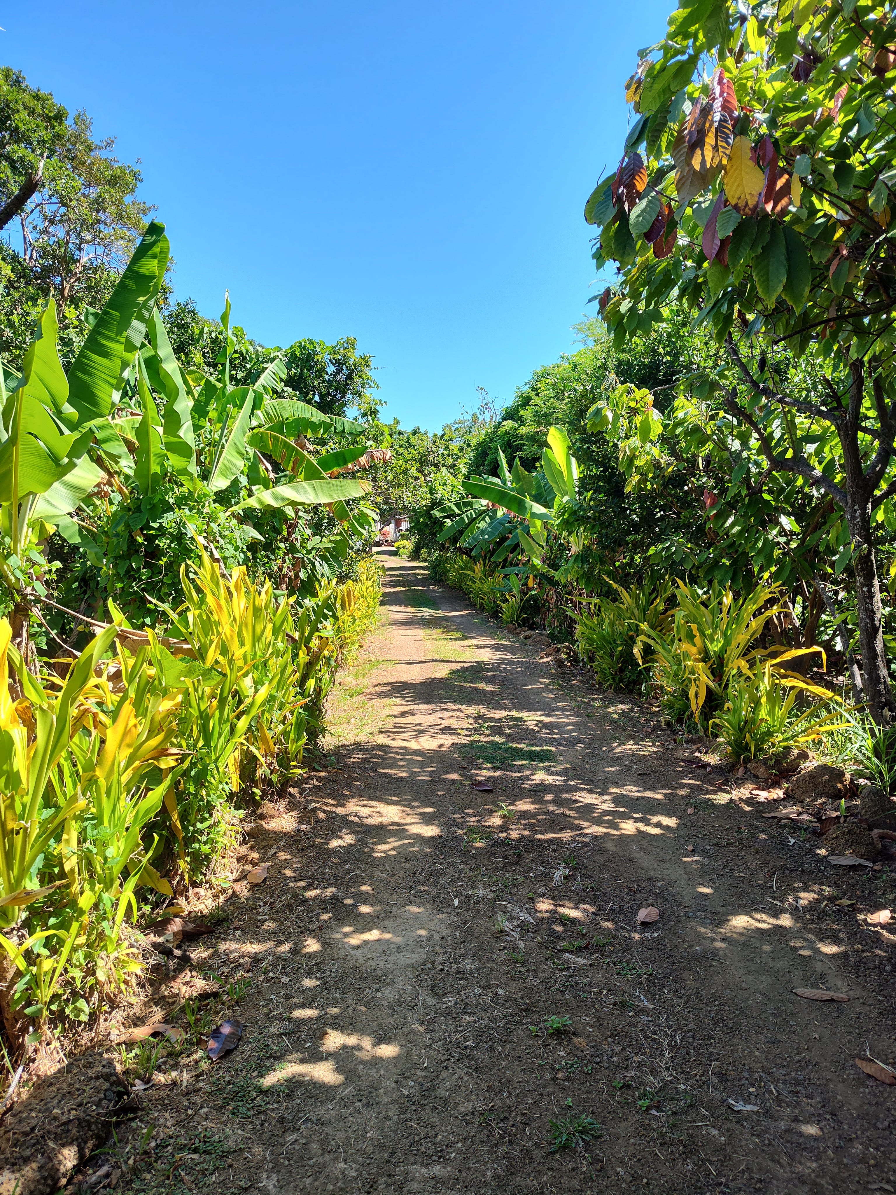
Both islands depend on agriculture and, recently, tourism. Over time, much of the plantation land has been broken up into parcels and sold or otherwise distributed to small holders. Parcels vary, but 10 or 15 acres is a lot, and many are much smaller. Economists call this a peasant economy, which sounds slightly disagreeable but is not meant to be. Small parcels seem to suit the people and, in some way, must hark back to the days of slavery when the people were allowed “provision grounds.” I met any number of men in rubber boots with cutlasses (machetes) in their hands and a bag over their shoulder cheerfully walking to or from their patch. Even these small operations can produce useful amounts of tree fruit (bananas of various sorts, mangoes, cocoa, nutmeg, sour sop, breadfruit) and vegetables. You see vast amounts of this stuff in the market at St. George’s or Hillsborough or in makeshift shacks along the road. Also many people manufacture jams, jellies, sprays, and tinctures, which they also sell in the market.
Carriere Estate
I was on the island with a mission to explore particular plantations that I have been studying. I didn’t go near the tourist beaches. I went straight from the airport, over the mountains at Grand Etang, to a village called Moya north of Grenville. One of the curious things about Grenada is that there are no street addresses. The apartment I rented in Moya was known only as “the concrete house opposite Ben Jones’s house on Pearls Main Road.” Ben Jones, now dead, was once prime minister, which somewhat helped the cause. But I was also told to go and meet “the old woman who lives by the pasture.” And the place I stayed in St. George’s is called the Priory, no other designation. (Another local custom: no one goes up to the door and knocks. You stand outside and shout the person’s name until he or she comes to the door. The first couple of times this happened, I was alarmed and sheepish. I could never bring myself to shout very loudly.)
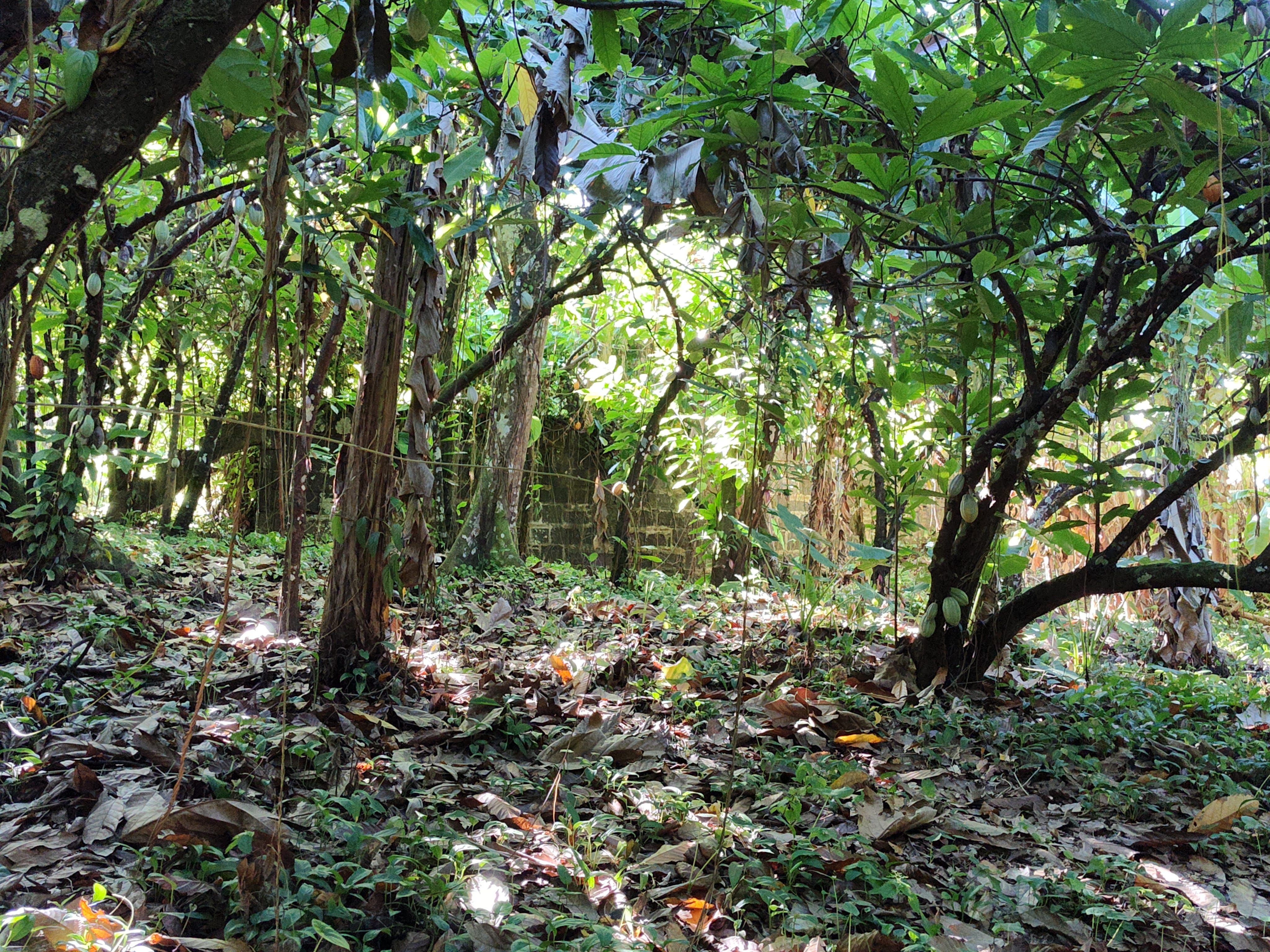
I hiked up the road from Moya to where the Carriere Estate used to be. This in itself was alarming. Grenadians drive on the British side of the road. There are no sidewalks. They race along beeping their horns at turns, slowing now and then for the occasional massive speed bump. I was warned sternly to watch the traffic. That first night, when I arrived and got out of the taxi, my landlady had to sprint across the road and push me out of the way.
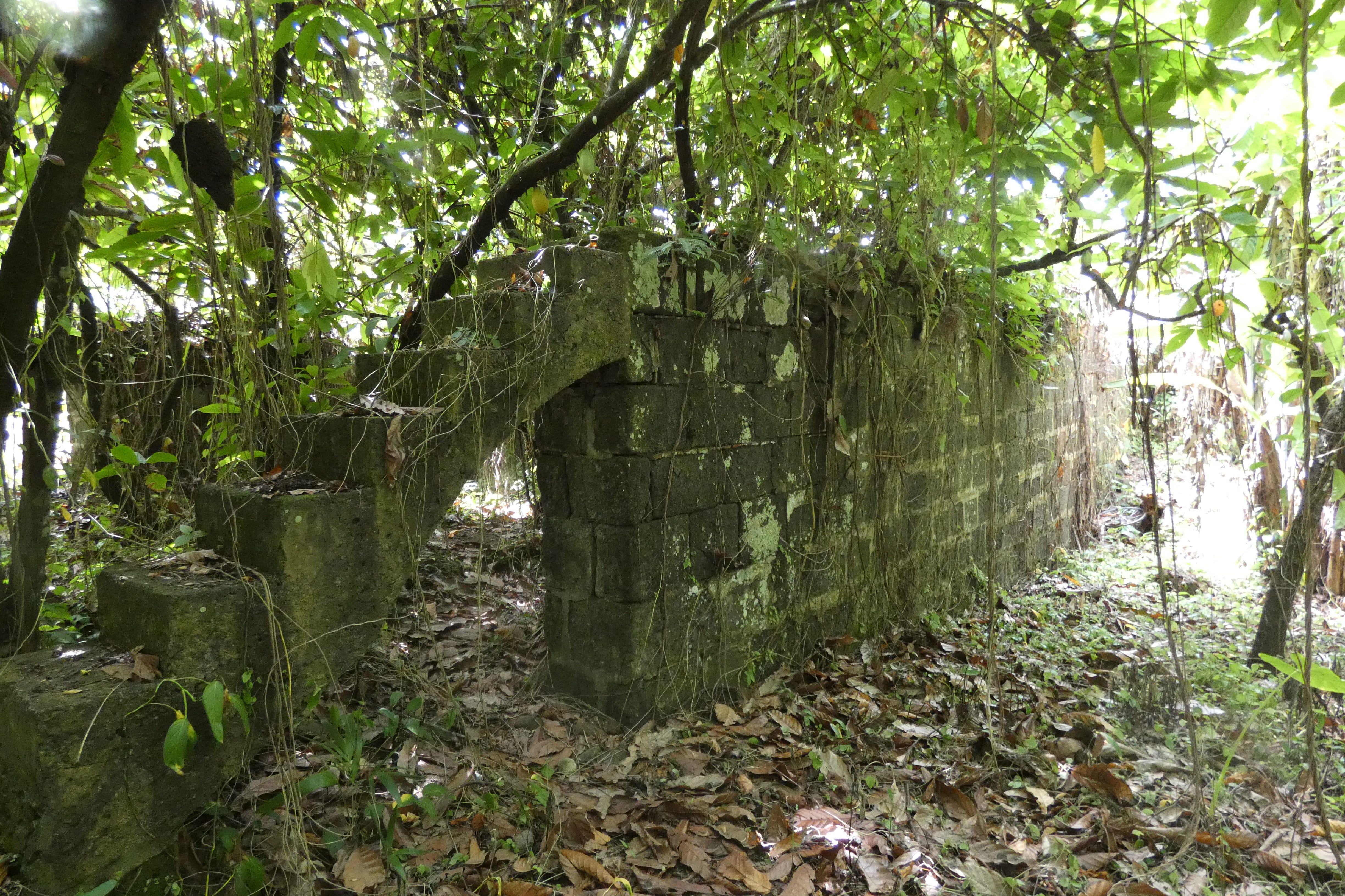
Carriere had disappeared as far as my research could tell me. Modern maps occasionally slap the name down in a vague way, but there is no village called Carriere and no estate lines. No one mentioned any ruins. When I got to something like the right place, I asked a guy by the road if he knew of any ruins. Oh sure, he said (he was speaking with a Grenadian accent of which I could understand perhaps 60% on a good day — the patois is French-based, not English). He waved his hand. Just go up there and take the path on the right to the cricket ground. Of course, there was no path, really, and what he called the community cricket ground was a pasture occupied by two cows, half-a-dozen goats, and a cattle egret. But as I cut between two houses, I glanced to my right and was shocked to see this stone structure, what my dreams were made of.
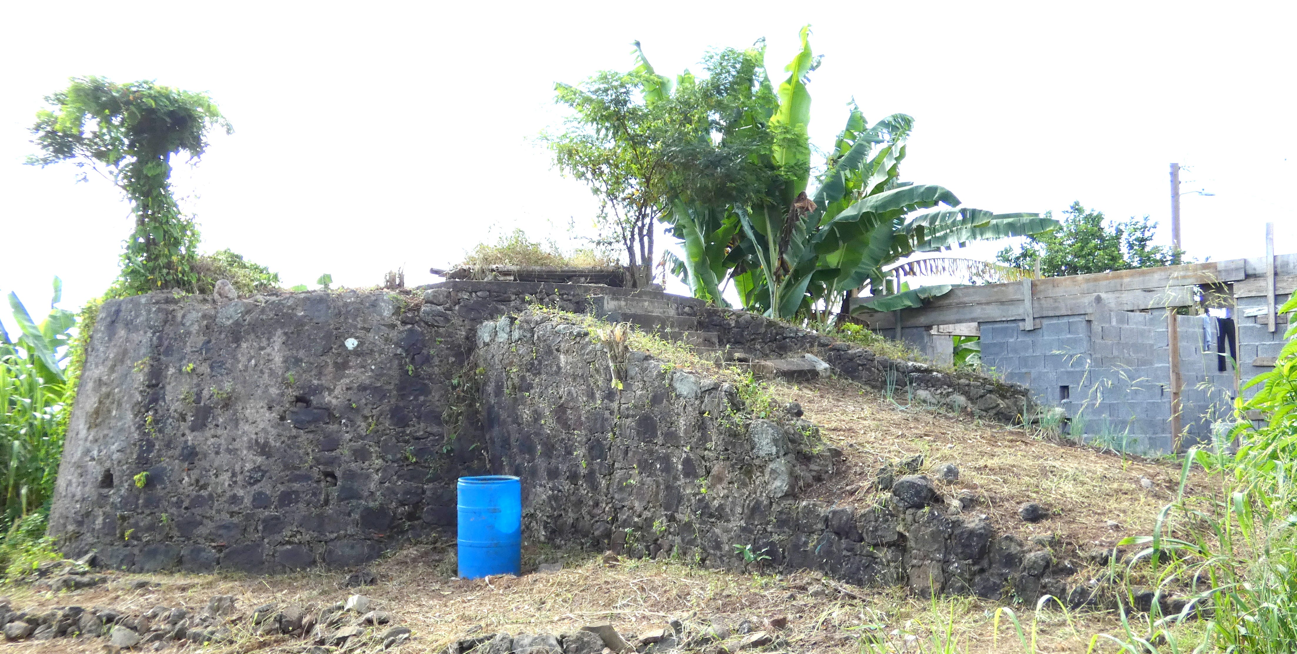
I had found the Carriere ruins.
I think this was the base for a windmill, but I am a neophyte at interpreting plantation ruins. I wandered around and found a wall that proved to be the dam for a water reservoir used to power a waterwheel. I found the stone-walled channel for the waterwheel and the ruins of the mill house.
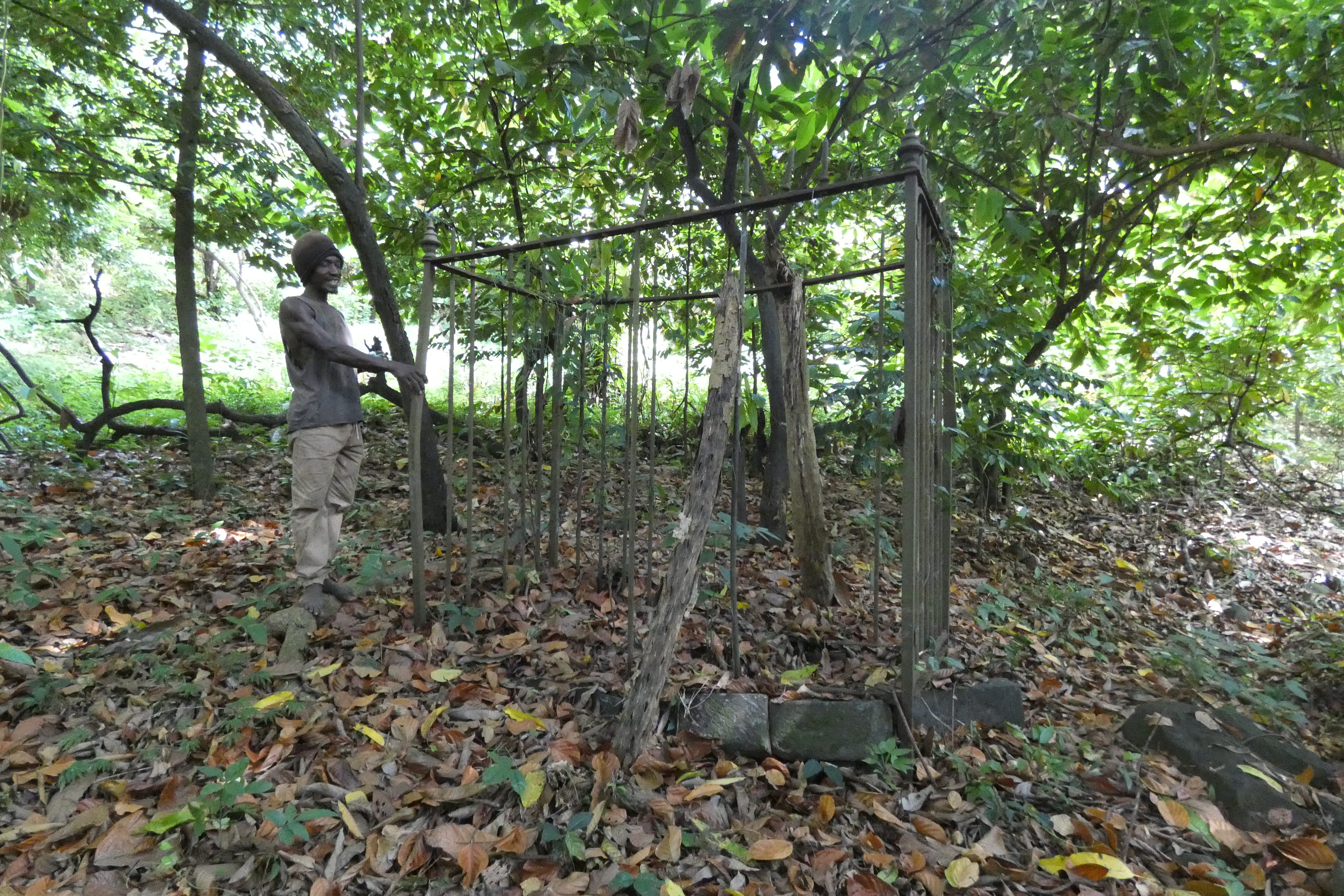
The guy who had directed me in the road, Augustus Charles, caught up with me at this point. In fact, he owned the old mill and used it as a joinery shop. He pointed out where the plantation smokestack had once stood, then took me deep into the woods (overgrown cocoa plantation) to a lone grave with a wrought-iron fence and smashed gate lock.
I had an introduction to a man named Peters who lived in what was billed to me as the former estate house. So we went there and Augustus embarrassed the hell out of me by walking around the house shouting “Vince! Vince!” in what seemed like an aggressive manner. But then Vincent Peters came out, in his sixties, a bit frail and coughing, on the phone with his daughter in Canada. You could see the Atlantic and feel the cool ocean breeze from his porch. His parents were buried in the side yard near the cocoa drying rails. And, no, it wasn’t the estate house. That was somewhere higher up — he waved his hand vaguely. I asked him to show me. He looked at me dubiously. Perhaps we should wait for another day when his brother had returned his car, he suggested (remember, I am only understanding some of this). But I convinced him I could hike whatever it took. He changed into the uniform (long pants, rubber boots, cutlass) and off we went.
Three thin dogs came with us. Two were Vince’s and one, the emaciated black one, belonged somewhere else. It was the black one who seemed most protective of Vince. After a while, I asked Vince if he let his dogs into the house at night to sleep. No. I asked if he fed his dogs. No. Then I asked, “Well, if you don’t feed them or let them into the house, how do they know they are your dogs?” which made him burst into laughter. (Further to the point: I saw no fixed male dogs in Grenada; I saw two three-legged dogs.)
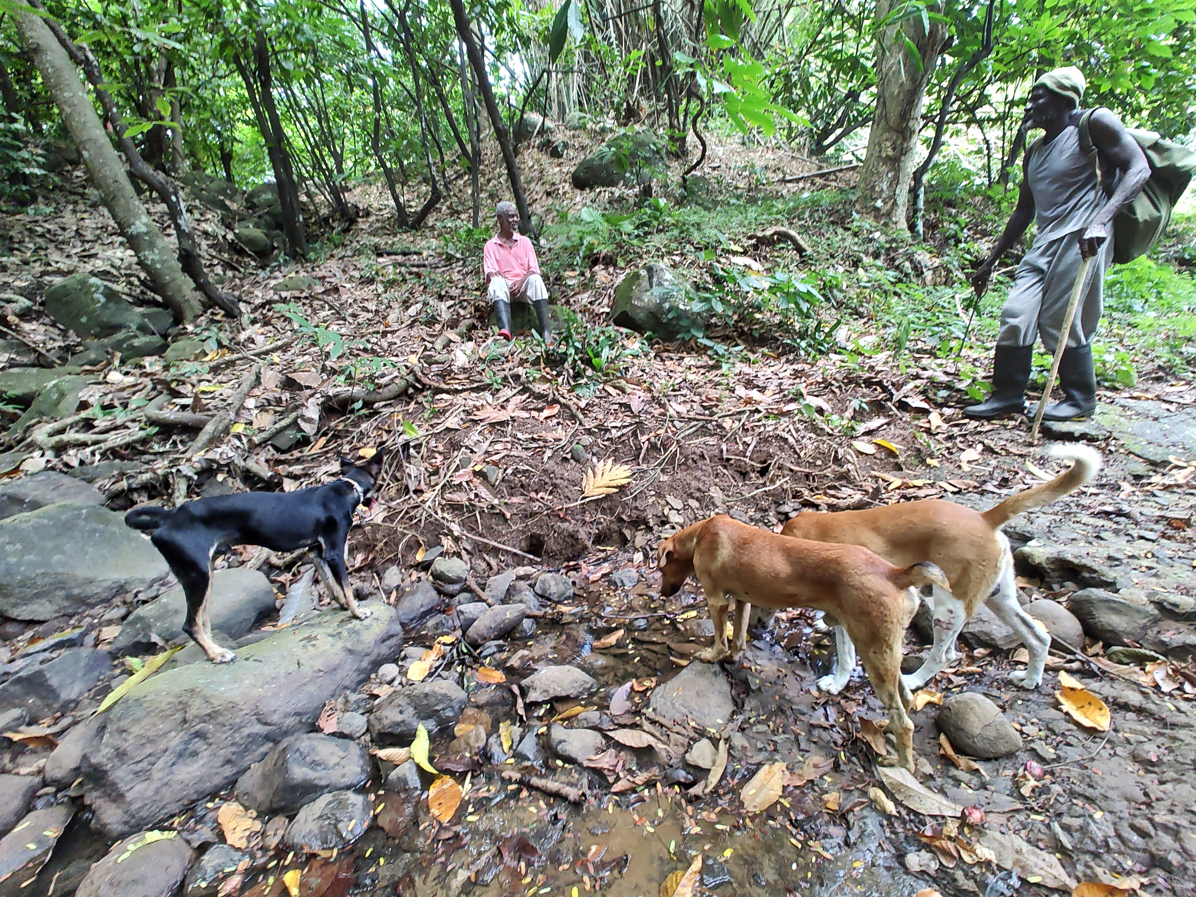
It took more than an hour winding up through the cocoa plantations (crisscrossed with rows of massive mango trees for windbreaks) on a path that even he lost now and then (we would stop other lone men with cutlasses and rubber boots to get our bearings) to reach the plantation house, if it was the plantation house. It had clearly been rebuilt, but it was in roughly the right place, high up and facing the ocean, free from mosquitoes and fronted with huge palms (according to Angus Martin, the estate houses were usually a distance from the works and planted with palms). Vince wouldn’t let me go near because the owner was not there (his truck was gone) and there were dogs milling about.
Mount Rich
Mount Rich was an old sugar estate, another three miles or so along the road past Carriere (shorter by the road through Tivoli). It’s sunk deep in a valley (volcanic caldera) with a river (creek) running through. Once again, I was not hopeful about ruins. I could never find any mentioned in my research, except that everyone did mention the old damaged estate house (and slave pen) up on the hill east of the village. This estate house is modern (if in ruins). It was built by the Kent family who bought the plantation in the 1870s, 35 or more years after the end of slavery. The so-called slave pen is a storage building. The family graves are in the back yard.
Naturally, when I asked about Mount Rich ruins, someone named Dexter offered to show me the Kent house for $20. I did not think that much of a deal since I could very well see the house from the road where I stood. In the end, Dexter disappeared and a guy named Roy walked up with me. He was affable and quite knowledgeable about the agriculture (showed me cocoa pods and nutmeg and mace and melons planted all around the old house by the locals). He did not try to tell me the stone storage unit was a slave pen. He said he thought they kept machinery there. His grandmother had worked for the Kents, and he remembered coming up to the house with her after the Kents had gone and it had been converted into an Anglican church.
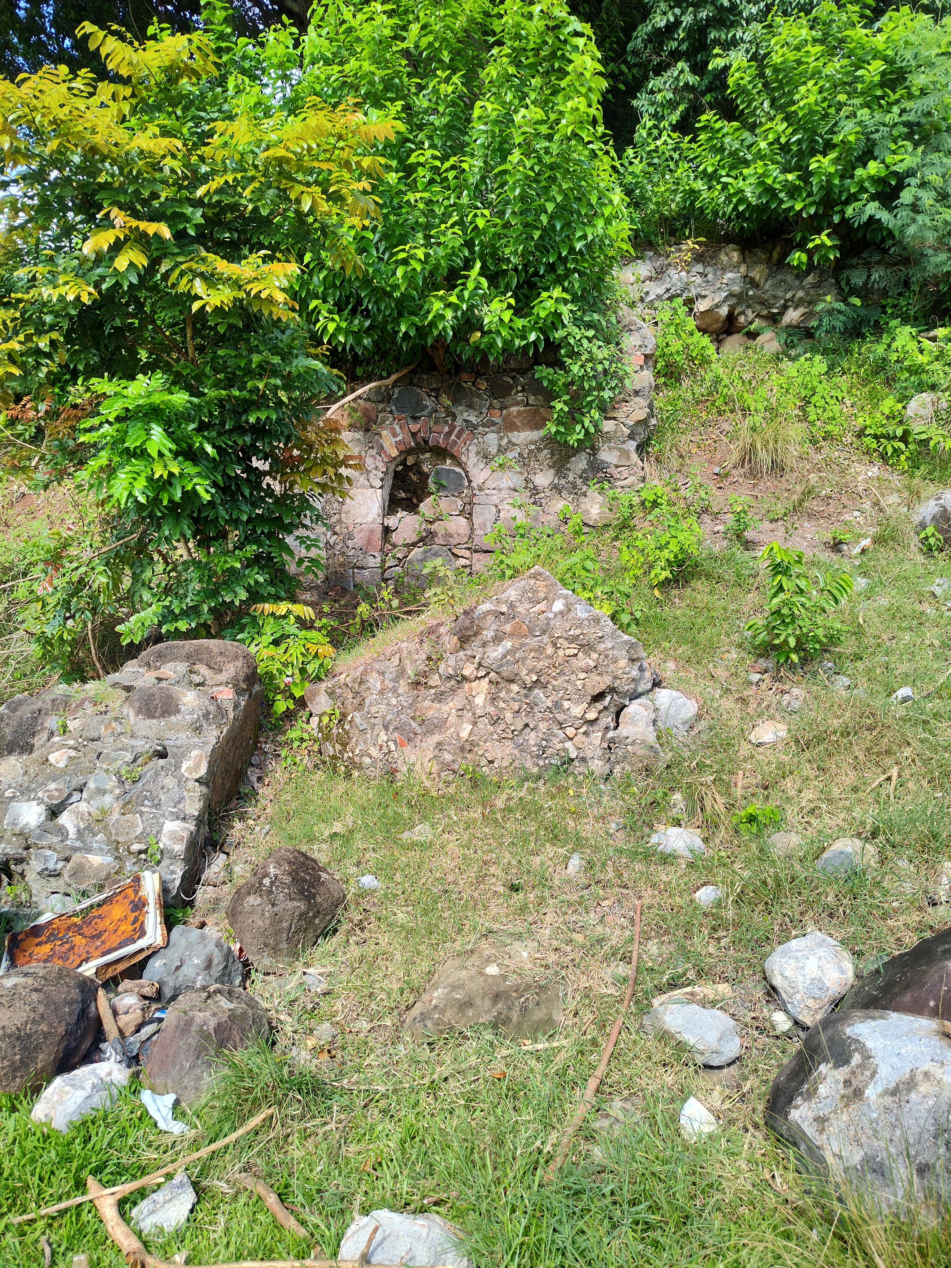
But this wasn’t what I had hoped for. I knew from the paperwork I had that the old village where the enslaved people lived had been down in the valley on land where the town cricket ground stands (modern and well kept, not a cattle pasture). I wandered back down there and spotted a yellow sand road going off behind the cricket ground and a school (full of sweet little kids, all spic and span in white shirts with khaki pants and skirts — they were singing the itsy-bitsy spider song as I walked by). Within 50 yards, I started to see the ruins overgrown with vines and bushes, a long roofless stone building with iron bars on the windows (everyone puts bars on their windows in Grenada).
I scrambled around. There were old cocoa rails in the back, also a small shaft for a possible water wheel (on my 1869 plot of the estate there is a canal drawn in), several other structures, and a strange pair of parallel walls with stepped ends. The research I had done had never mentioned the existence of these ruins. As with Carriere, I had been resigned to finding nothing. But now that I have seen them, I can actually spot them on Google maps.
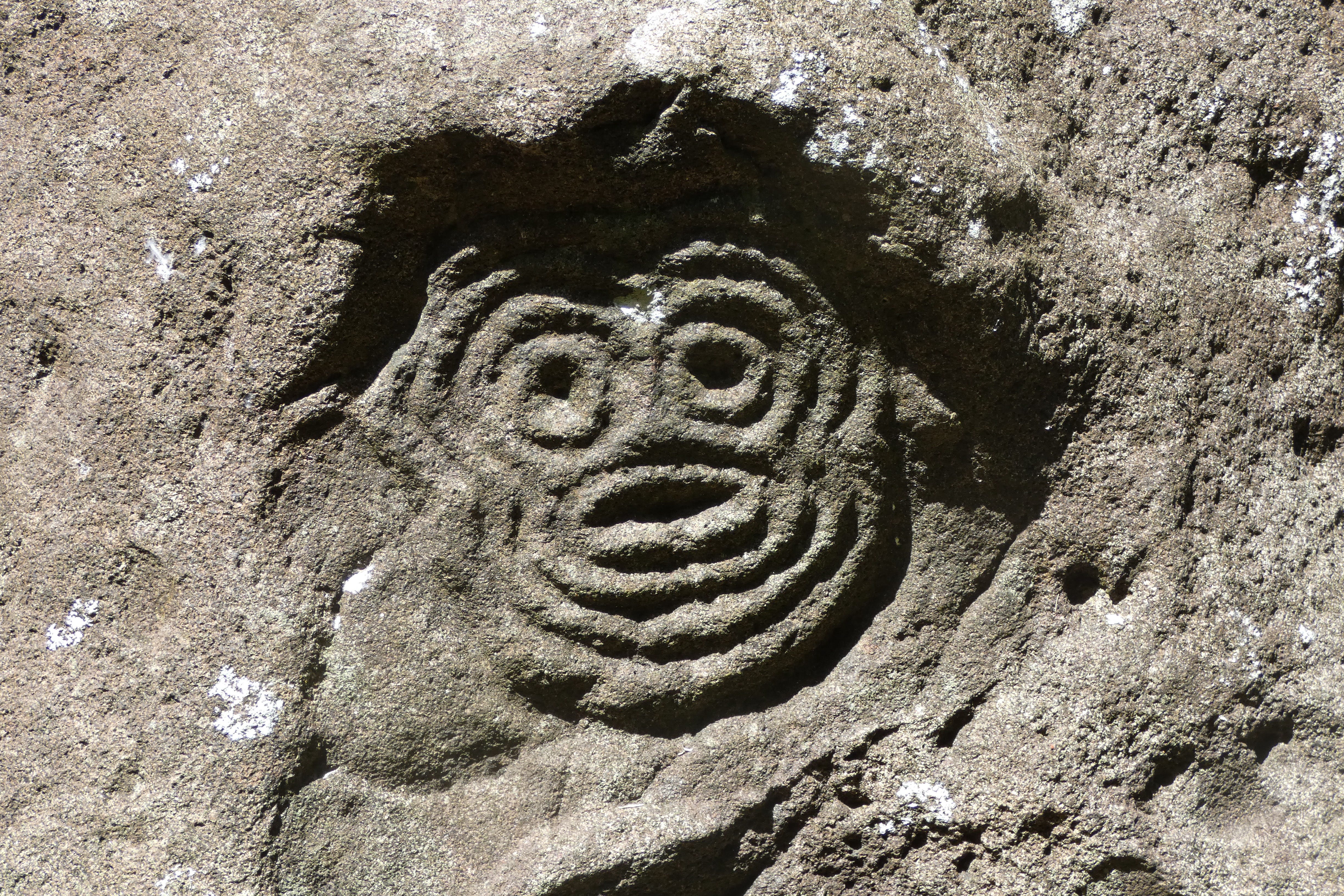
Over two days, I rambled all over the place and up into the hills behind, either bushwhacking or strolling along beautifully peaceful dirt pathways with nary another soul in sight. Just a couple of hundred yards away in a ravine where the river runs there is the famous Carib stone, a huge boulder bigger than an Abrams tank with eerie faces and strange triangular designs, like star plots, chipped into it. It was not easy to get down to the stone and when I sat on another rock in the creek to rest and look, I discovered more designs carved into it.
Behind the ruins up the steep hill, you find yourself dropping down into a bowl, an ancient caldera, the locals call “the lick.” A solitary walker (boots and cutlass) said it would fill up with water in the rain, but mostly it was full of cocoa trees. Far up, the road swung out along a narrow spiny ridge, dropping down precipitously on either side. I had an introduction to a woman named Valerie Benjamin who lived at the end of the road, deep in the bush. I had phoned her, but she never answered. I met a man named Henry (rubber boots, cutlass) who said I should just barge in. He would take me but he was on his way to work in his patch of land. Watch out for the dogs, though.
I am a shy person. Barging in is not my thing. But I had only one chance at this. The road ended at Valerie’s compound at the tip of the ridge, overlooking the Atlantic in the distance. There were maybe a dozen dogs, all on long leads staked strategically around the property. You couldn’t get past them to the house, it seemed. They were intent on mayhem. I stopped and told them my business, which didn’t at all deter their joyful outcry (I was the most entertaining thing to happen in days, it seemed). Finally, Valerie appeared and laughed and waved me in. The dogs were her security system.
It turned out that Valerie actually owns the ruins I had been looking at, inherited from her late husband. She owns the land on the riverbank next to the Carib stone, too. Her house is an old plantation house, expanded and rebuilt, but still showing the ancient stonework. She has her own cocoa operation, rails and drying pans, and a boucan with fermenting bins and wooden shovels for turning the cocoa beans. She also has goats, pigs, and chickens, a cistern, mutiple garden plots, a lovely open outdoor patio surrounded by palms and flowering vines. All of this up in the sky as it were. This was a delight to see, and an object lesson in how the layout of a plantation might have worked in the old days in miniature. We tend to think of them as monocultures (sugar, cocoa, cotton), but every indication I have seen shows them to have diverse agricultural operations going on simultaneously.
Anse la Roche, Carriacou
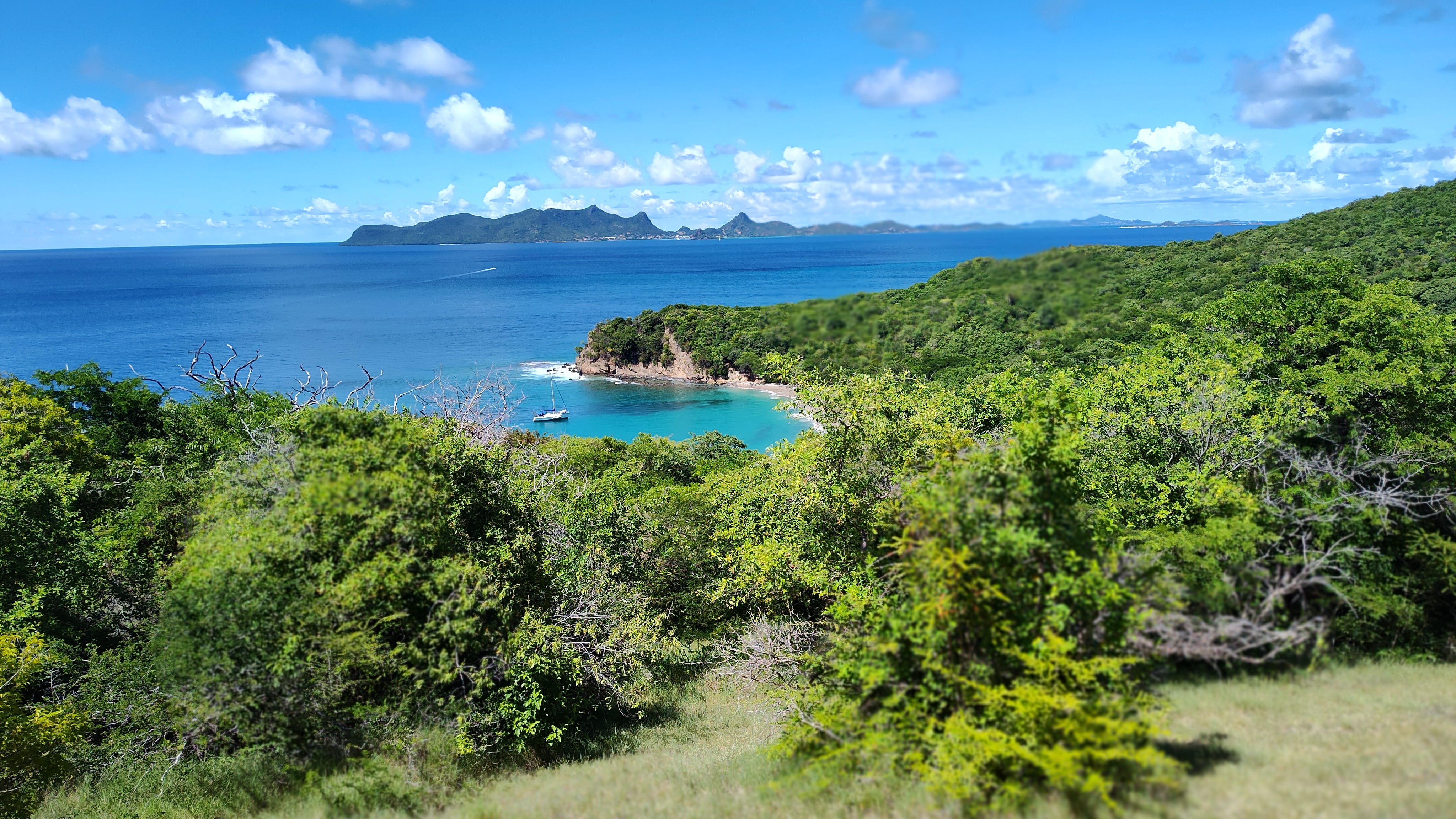
L’Anse la Roche2 on Carriacou is in the northwest corner of that little island. I hiked up from John’s Unique Resort where I was staying in Hillsborough. They were having a heat wave, everyone told me. You can’t walk that far. Also it’s very hard to find the ruins. Actually, it was difficult to find the ruins. Nobody could give me directions that made sense, and where the estate had been is completely overgrown with forest and dryland bush. After a little place called Bogles, the road becomes a track that leads along a contour line straight north to the tip of the island where it joins the road to Windward. The way is shaded with tamarinds and, in one place, a poisonous manchineel tree. There is a faint path at one point that leads down steeply to Anse la Roche beach, which is touted as gorgeous but best reached by boat. I hiked up past the beach trail and thinking I had overshot the ruins turned down toward the beach along what might have once been a path but was sort of a wide dry grass track with acacias on either side that sometimes spread out on either side into a meadow. After a while I could hear the breakers. I had not intended to visit the beach, but I was clearly going to find the beach before I found the ruins. So on I went.
Several sail boats at anchor. Union Island in the offing. One person swimming. Beach perfect, a gem, ripe for development and ruin. I realized I now had to go swimming. So I went down to where the man was snorkeling and got his attention and asked if it was safe (Merle Collins’s novel The Colour of Forgetting mentions rip tides and deaths by drowning and had put the fear of God in me). The man was an Australian named Mark, a former media person and journalist, who sailed around with his wife Marjory (I met her later in the water where we floated around talking) and apparently did nothing else. I told him I was looking for ruins. He knew where some ruins were, pointing up to a steep point at southern tip of the bay. He had been trapped at Anse la Roche during COVID, he explained — he had done “a lot of hiking” to pass the time. He’d found the cannon emplacement at the top of the point (marked on my old maps) and maybe half-a-dozen curious stone structures. It had never occurred to him that it was a farm. He had thought it was all a military base. Much of this he explained to me while we were out floating in the bay, water warm as a bath, heaving with a gentle yet powerful swell, clear as window glass.
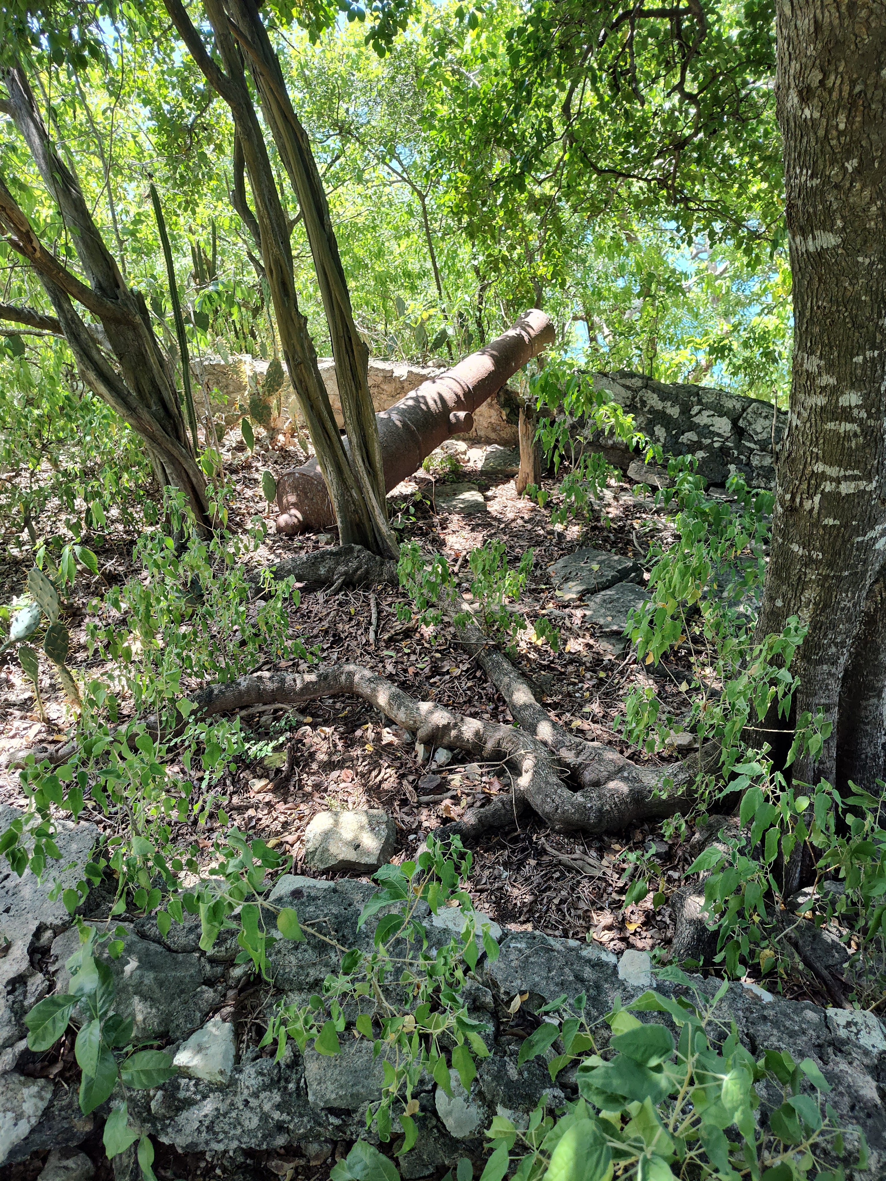
With Mark’s instructions in mind (go up the path until it jogs to the left, then look for a faint game trail on the right and follow it, then bushwhack) , I started up the beach trail and immediately got lost (there were faint cattle trails everywhere). But I knew that I would find the cannon and such if I just climbed to the top of the ridge. So I bushwhacked and scrambled and there they were. I had seen a YouTube video of these ruins, produced by Rina Mills who works in the tourism office in Hillsborough. And my friend Philip Thorne, whose cousins still own two parcels of estate land, can remember his grandmother baking in what’s left of an old stone oven when he was a boy. They were not so mysterious as the lost structures of Carriere or the false ruins of the Kent House at Mount Rich. But it was exciting to stumble upon the cannon and then work my way back along the ridge, finding stone wall after stone wall. I took photos with geotagging, which I’ll send to Angus and Rina, so no one will ever have trouble finding them again.
[Trigger Warning: At the risk of inviting universal ridicule, here is a short video of me wandering amongst the ruins. I am alone, talking to myself, totally humiliating, especially when I start talking to the hermit crabs. So you may want to turn off the sound to prevent secondhand embarrassment.]
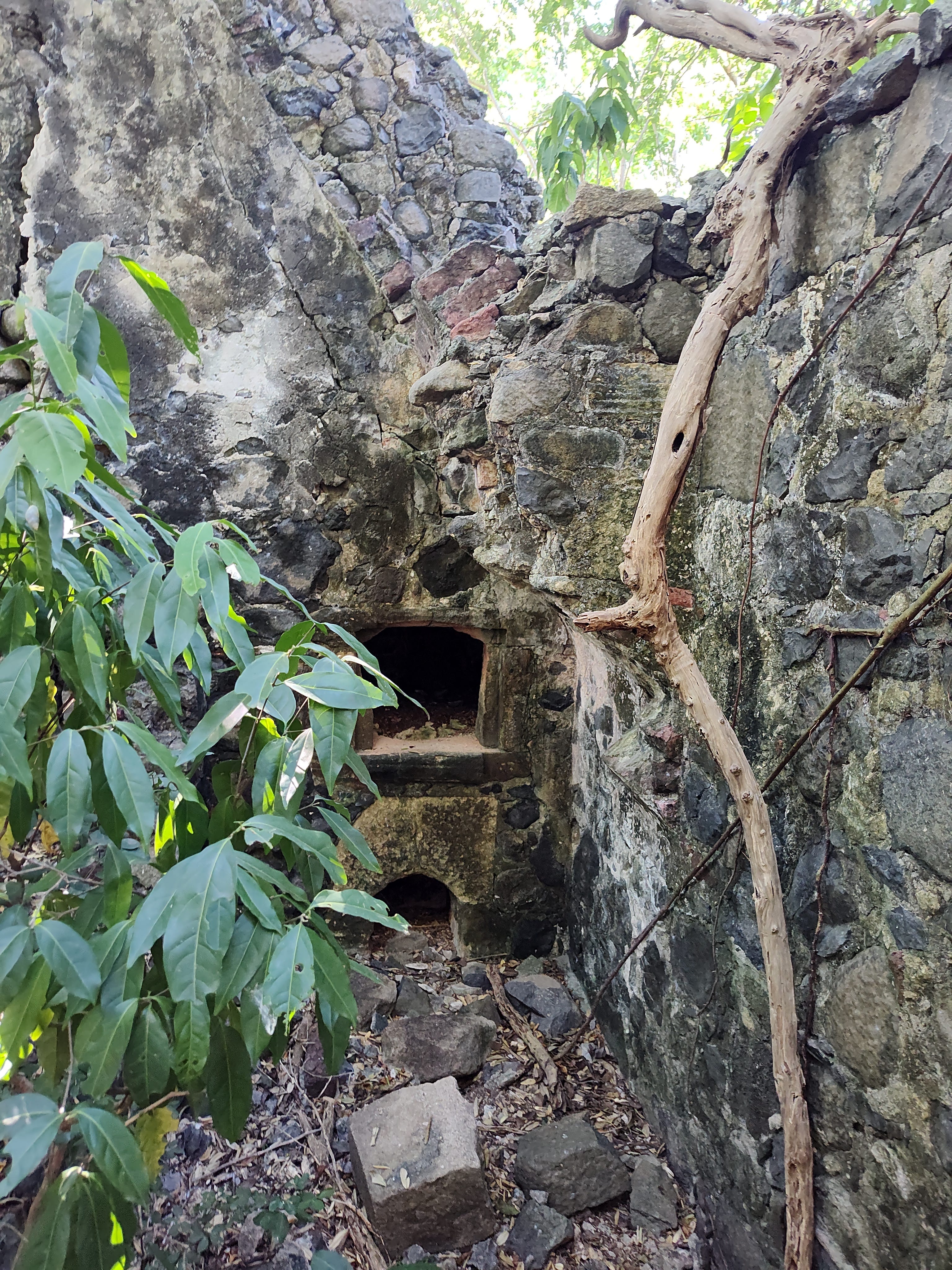
I knew from the old estate papers I had (not much) that there was cotton and corn grown here, and cattle grazed on the upper slopes. No doubt they also raised pigs, goats, sheep, and chickens. I found a house-like structure with stone partition and an oven at one end. The oven extended beyond the outer wall where there would have been a chimney. I doubt this was the estate house, more like an large kitchen building. Though, again, I am only learning to interpret. Next door, up a flight of three steps, was something too ruined to read (except for the jawbone of a horse and some other large animal bones strewn about) and then a large sunken paddock (stone walls all around). I doubt the estate house would have been that near to the animals.
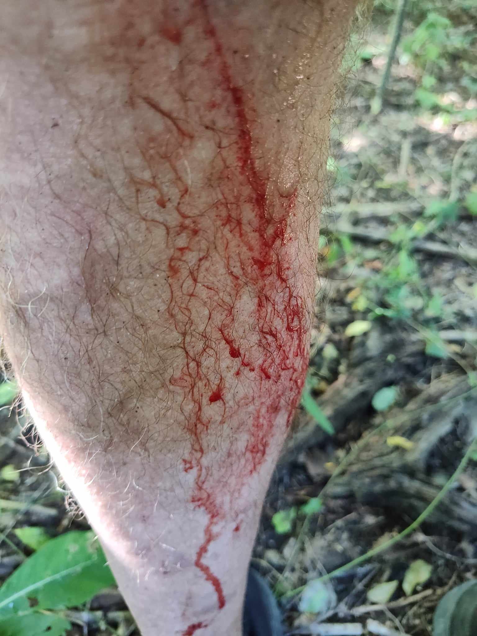
The cacti and acacia, as I say, turned my legs into hamburger (I should have worn long pants and boots and carried a cutlass — how I longed for a cutlass). But this place fascinated me so much that I came back a second time to scramble around and try to make sense of what I was seeing. For an age, I sat on a ruined wall and tried to imagine what it had once been like with a couple of hundred enslaved people and a planter and overseer, dogs barking, roosters crowing, all that life and sadness. I remembered the voices singing The Itsy Bitsy Spider at Mount Rich and thought of the children here, born into slavery.
Grenada does not take terribly good care of its past. The national museum in St. George’s is closed. The national library hasn’t been open since 2011. I went through the national archives, where the ceiling is collapsing from water leaks. All the ruins I visited are unmarked, ruins of ruins where people are free to wander and mine for cut stone and bits of iron, which they do. In one place on Carriacou, I saw old gravestones bulldozed up into a pile and left. So it felt important to me that I go and see where the terrible past lies hidden, where enslaved people walked and suffered and yet survived, made love, bore children (for who else are the people here but descendents of those children?). I felt such a terrible sadness now and then. Yes. But now that I am home I keep hearing those happy children in the schoolyard at Mount Rich, singing.
I will have more to say on this in another substack post.
This is not correct for the island of Grenada. If you look online, you get many different figures. I am pretty sure this is the total for the country of Grenada. From what people are telling me, 112,000 is closer to the actual number for the island itself.
The written named is “L’Anse la Roche,” originally a French plantation. But everyone calls it “Anse la Roche.”
Thank you telling us about your visit to Grenada and Carriacou, Douglas. I look forward to hearing more as I also have family connections, being descended from Andrew McInnes. Currently transcribing some 17th century documents which relate to Andrew's ancestors. I probably have information that you would be interested in and would be happy to compare notes.
Good job. Fun to go wandering with you. 👍Glad you gave us some important though shameful history.